

Oireabhal [Oreval]
Good walks are even better shared.
NB0809 : Oreval summit
Colin Kinnear Photo source
Overview
Oireabhal [Oreval]: A Hidden Gem in the Outer Hebrides
Introduction
Nestled in the enchanting Outer Hebrides, Oireabhal, or Oreval as some locals might affectionately call it, stands at an impressive 422 meters and charms hikers with its rugged beauty. This Marilyn offers a rewarding challenge and substantial bragging rights upon summiting.
Geology
As you traverse Oireabhal's slopes, you're walking on some of the world's oldest rocks – Lewisian gneiss that has stood the test of time. It's a geological wonder that tells tales of ancient Earth history. Just think of it as nature’s history book – albeit a bit stony and heavy to read.
Routes
The West Approach: This route takes you through marshy patches and grassy knolls affording delightful views of the surrounding landscapes. Make sure to pack some snacks; hiking is hard work, and a good biscuit can work wonders! The route spans approximately 6.5 km and generally takes about 3.5 hours.
Summit Features
Upon reaching the summit, you'll be greeted by a quaint stone cairn, ideal for your summit selfies.
Terrain
The terrain mixes grassy expanses with rocky patches. Be prepared for the occasional bog, as the Hebrides are quite happy to keep you on your toes – literally!
Views
From the top, you can feast your eyes on breathtaking views of Harris's mountains and the shimmering seas around the islands, a sight that could make a painter weep (or at least appreciate good scenery forever). The best time to admire these views is during spring or early summer when wildflowers dot the landscape.
Hazards
Typical of the area, be mindful of the slippery paths, especially if the heavens decide to open up above. Visibility can shift like the moods of a Scottish summer – brace yourself!
Nearby Summits
If you’re keen for further adventures, consider nearby peaks like Clisham or An Cliseam; they offer additional walking opportunities and stunning views all around.
Access
Use the A859 for parking, with limited roadside options. For a more adventurous commute, consider the local buses or car hire from Tarbert, where you can also stock up on food essentials.
Facilities
While Oireabhal doesn’t have toilets (you'll have to make do with nature), nearby Tarbert has cafés to fuel up before or after your hike.
History
The meaning behind Oireabhal speaks volumes – 'sheltered mountain' – a fitting designation for such a majestic natural feature that has captured the hearts of hikers and local folklore alike.
Now that you’re all set with the facts, lace up those hiking boots, and make your way to Oireabhal. Just remember: the views are free, but the memories last a lifetime!
Explore routes near Oireabhal [Oreval]
Walks starting near this hill. Open a route to check its map, distance and full itinerary.
Beautiful private beach walk Isle of Harris
View route
Berneray Community Hall to the beautiful beach
View route
Route planning notes
These notes describe possible approaches. Check a route's map and access information when planning your walk.
The West Approach
This route starts from the small road south of the mountain, leading you through boggy terrain and grassy slopes before tackling the summit's rugged section.
Make a day of it, together
Find someone to share the walk with, or organise a day out along a route you like.
Photo Gallery
View all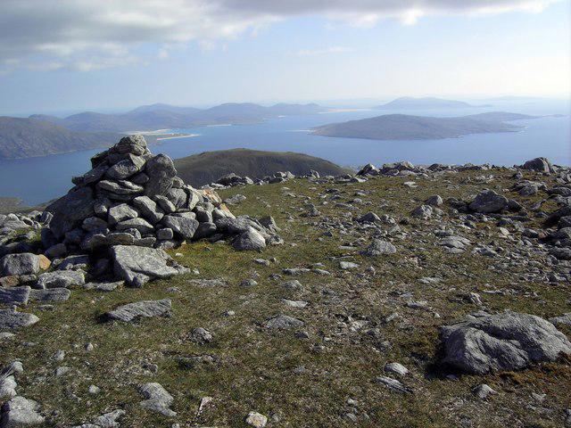 Photo could not load
NB0809 : Oreval summit
Colin Kinnear
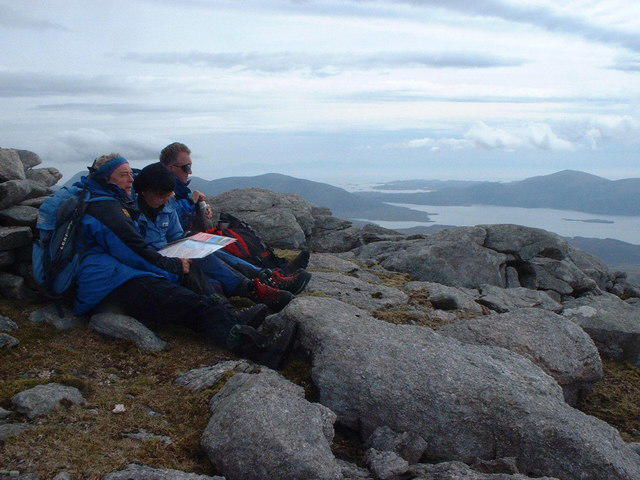 Photo could not load
NB0809 : Rocky summit of Oireabhal
Russel Wills
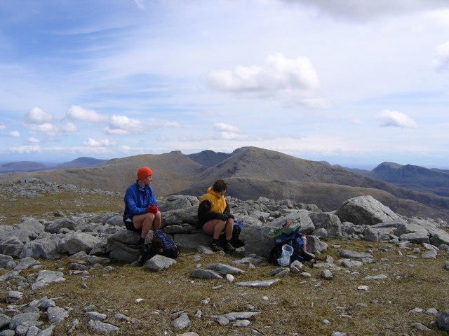 Photo could not load
NB0809 : Summit of Oreval
Andrew Spenceley
 Photo could not load
NB0809 : Panorama from top of Oireabhal
Russel Wills
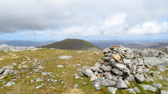 Photo could not load
NB0809 : Summit cairn on Oireabhal with view towards Ulabhal
Colin Park
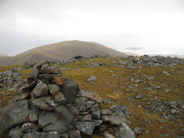 Photo could not load
NB0809 : Oireabhal summit
Richard Webb
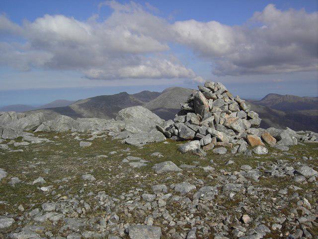 Photo could not load
NB0809 : Oreval summit
Colin Kinnear
Hill facts and local notes
Classifications
Elevation
662m
2,173 ft
Prominence
419m
Coordinates
57.9831, -6.9352
NB083099
OS Map
13 14
Explorer: 456
At the Summit
The summit boasts a small stone cairn, offering a perfect photo-op for all those social media enthusiasts. From this point, one can truly appreciate the wild beauty of the Outer Hebrides.
Terrain & Geology
Oireabhal is primarily composed of ancient Lewisian gneiss, formed over 3 billion years ago, making it one of the oldest geological formations in the UK. The rock layers give the mountain its rugged character and provide a glimpse into the geological history of the region.
Views & Scenery
On clear days, the views stretch to the mountains of Harris and the turquoise waters surrounding the islands, providing a postcard-perfect panorama. You might even spot the St Kilda archipelago in the distance!
History & Heritage
Name Origin
The name 'Oireabhal' derives from the Gaelic term meaning 'sheltered mountain', which is quite apt considering its commanding presence amidst the windswept landscapes.
Historical Significance
The mountain has been an important landmark for local navigators and a source of inspiration in Gaelic folklore, with tales of mythical creatures said to roam the hills.
Getting There & Facilities
Parking
There is limited roadside parking along the A859, with a small pull-in area suitable for a couple of cars. Arrive early to secure a spot, particularly during the summer months.
Public Transport
Local buses run from Stornoway to various parts of Lewis, but it’s best to check the local schedule. Alternatively, hiring a car offers more flexibility.
Nearby Facilities
While there are no facilities on the mountain itself, Tarbert offers several cafes, hotels, and public toilets. The Hebrides are known for their warm hospitality!
Safety Information
Known Hazards
- Uneven and slippery paths, particularly in wet weather. Visibility can also change rapidly, so keep an eye on the sky if it looks like British tea time upstairs.
General Safety Tips
- Check weather conditions before setting out
- Carry appropriate clothing and equipment
- Let someone know your planned route
- Take a map, compass, and GPS device
- Carry emergency supplies: food, water, first aid kit, torch
Hills
Some common questions about the hills answered
Are there group walks up Oireabhal [Oreval]?
Many walkers use Walkmates to join or organise walks with others. You can check for group walks around Oireabhal [Oreval] through the maps
Are there other walkers around Oireabhal [Oreval]?
Activity varies by location and time, but Walkmates lets you see whether others have shared walks or shown interest in this area. Find other people through the walking friends search walking friends for Oireabhal [Oreval] search or of course create your own walk for Oireabhal [Oreval]
Can I organise a walk to Oireabhal [Oreval]?
Yes. If there aren’t any walks listed already, you can create a walk and make it available for others to join.
If you're signed up to Walkmates, you can create a walk to Oireabhal [Oreval].
How do I find a walk up this hill?
There are often multiple ways to walk this hill, depending on experience and route preference. Walkmates helps you explore walks and routes that others have shared.
Can I suggest a new route up Oireabhal [Oreval]?
Yes. You can suggest or create routes to share with others. Walkmates focuses on the social side of walking, so routes are used to help people organise walks and explore areas together, rather than as detailed navigation tools or route libraries.
Other uses really appreciate knowledgeable walkers sharing their routes. Share your favourite route to Oireabhal [Oreval] here
The is an error or something incorrect about this hill. How do I let you know?
We always strive to keep the information on Walkmates as accurate as possible. If you find an error, please let us know through the contact form and we'll aim to correct it as quickly as possible
Community Discussion
Comments
Location
![Oireabhal [Oreval] location map](https://cdn.walkmates.com/hill-maps/hill-sources/1590/57.98306_-6.93522.png)
Grid reference: NB083099
View on OpenStreetMapOpens a map in a new tab, centred on the hill.
No comments yet. Be the first.